
Environmental Stewards
There’s a reason we spent more than 8 years and $150 million conducting the most extensive environmental studies ever undertaken in Alaska. The Environmental Baseline Document (EBD) is a critical component guiding an environmentally friendly mine design.

Environmental Baseline Document
This study provides an understanding of environmental characteristics as they exist today, on a physical, biological and socioeconomic level. Minimal impact on the ecosystem is the goal, so that day-in, day-out, the natural rhythm of the place is as unchanged as possible.
Because in building this mine, we expect to be held accountable. We wouldn’t have it any other way. Today, these studies have led to a new path forward, a new plan, smaller by 50% and with significantly less environmental impact.
Windy!
That’s what you'd probably say, if you had to choose just one word to describe conditions at the Pebble Deposit. According to the climate scientists who monitor the area’s meteorology stations, wind conditions at the mine site can be described as “calm” less than 2% of the time. Hold on to your hats, folks!

In the summertime, the maritime influences of Iliamna Lake, the Cook Inlet and Bristol Bay tend to cool the air, keeping summer temperatures mild. The warmest temperature documented at the Deposit in the EBD was 75.7° Fahrenheit. In the winter, the lake freezes over and the bay ices-up, so they play less of a moderating role; winters at Pebble are overcast and damp. Occasionally, there’s a hard cold snap when frigid Arctic air moves in, but that tends to be brief. The lowest temperature recorded at the Deposit in the EBD was measured during just such a cold snap: -31.5°F in January of 2006.
Although it tends to be about 5° colder at the Deposit than at Iliamna Airport, typically, temperatures follow the same curve. You can get a good sense of conditions at Pebble by looking up the airport’s meteorological records (the airport code is PAIL).
Plants

The entire mine study area is in an ecological zone termed “low scrub shrub,” more than 80% of which is covered in low (under 5' tall) ericaceous shrubs, alders, willows and lichens. Roughly 10% is made up of “herbaceous vegetation” with a smattering of forest, and the rest is water (shallow lakes, rivers and streams).
Ericaceous shrubs are members of the heather family, Ericaceae, and they’re the most common plant in the mine study area. You’re probably familiar with some of the edible species of Ericacea, like the lingonberry (Vaccinium vitis-idaea), black crowberry (Empetrum nigrum) or bog bilberry (Vaccinium uliginosum).
There are also much less edible ericaceous shrubs, like the poisonous bog rosemary (Andromeda polifolia), which isn’t related to rosemary at all.
In some places, the willows and alders form thickets. In their understories, we find plants like Devil’s club (Oplopanax horridus), Alaska spiraea (Spiraea beauverdiana), broad buckler ferns (Dryopteris dilatata), white currants (Ribes glandulosum), and perhaps Alaska’s most distinctive flower, fireweed (Epilobium angustifolium).
Water
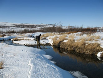
About 10% of the mine study area is surface water, and through rivers, streams and seepage much of it eventually flows into rivers that lead to Bristol Bay. Technically, there are eight watersheds in the Bristol Bay area. The Pebble Deposit is near the headwaters of three tributaries: the north and south fork Koktuli, and Upper Talarik Creek. Cumulatively, the three watersheds represented by these tributaries amount to less than 1% of the Bristol Bay Drainage.
Maintaining water quality will always be a concern, as many streams and rivers of the region are spawning and rearing grounds for all five species of Alaska salmon, as well as Arctic grayling, Dolly Varden, trout and other sport, subsistence and commercial fish. It’s very important that we understand as much as possible about the waterways and how they interrelate.
Surface, Subsurface and Quality
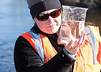
We funded years of research into the water of the study area — surface water and groundwater hydrology, and overall water quality — to develop a comprehensive understanding of both water quality and quantity, and how the different systems interact.
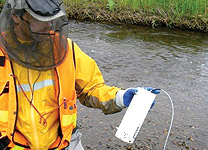
Through a network of automated sensors, stream flow was measured every 10–15 minutes during ice-free months, and manually through bore-holes after freeze-up. Piezometers installed at hundreds of monitoring locations recorded more than 14,000 groundwater level measurements to document subsurface water behavior.
And 3,400 samples were taken from streams and rivers, lakes and marshes, shallow- and deep-bore wells, testing temperature and pH, nutrients, ions, dissolved and trace elements, organic carbon and more.
What did we learn about water?
More than can be neatly summarized here — the details span six chapters of Pebble’s Environmental Baseline Document. A thumbnail description of the watershed would be a bit like describing the Mona Lisa as “an enigmatic smiling lady.” Accurate if you're already familiar with her, but not very useful if you aren’t. It’s complicated, and very much greater than the sum of its highly interrelated parts. As an introduction to the findings, we suggest referring to pages 37–46 of our overview publication, The Pebble Environment.
Wildlife
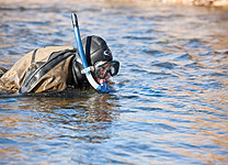
Co-existence. It’s not a term or goal the Pebble Partnership takes lightly—co-existing with fish and the surrounding environment is a core principle at Pebble. To support a cooperative mine design, we’re studying what species of fish are present and how they use the nearby streams.
Where are the fish spawning, rearing and feeding? What does the fish habitat look like and how does it function? How wide and deep is the channel? How fast are the flows? Are there pools, runs, riffles, backwaters? What types of organisms feed fish? This information, combined with water quality data, are part of the many puzzle pieces the Partnership is evaluating.


Studying the fish specifically and indications of impacts to the fishery is only part of the equation. However, the fact that fish migrate to sea for several years and are exposed to numerous threats from fishing to marine hazards, makes them poor indicators of local and real time impacts.
So Pebble also studies macroinvertebrates and periphyton, small stream dwelling organisms that are extremely sensitive to environmental change and tell us almost immediately of any changes to the local environment.
Mammals
A 2009 study, conducted in cooperation with the Alaska Department of Fish and Game, estimated about 48–58 brown bears per 386 square miles in the area surrounding Lake Iliamna. That’s a lot of bears that you might accidentally encounter while out in the field, and it’s why one of the important jobs that area residents have taken on during the project’s discovery phase is serving as bear guards.
It’s difficult for scientists and engineers to focus on fieldwork and maintain a constant lookout, so bear guards are trained to do it—and their traditional knowledge of the area is invaluable. When a bear is spotted, all work stops, and, if necessary, helicopters are called in. Getting people out of the bears’ way, rather than the other way around, is the fundamental principle of our bear program.
The Mulchatna Caribou Herd has a varied history of use of the area but currently their principal range is farther to the west. In recent years they migrate into the area around midsummer after calving elsewhere.
Of course, there are more than just brown bears and caribou in the study area. Biologists documented the presence, in low densities, of more than 40 species of mammal including coyote, river otters, moose, red fox, wolverines, black bear, beaver, tundra hare, lynx, gray wolves and martens. A 2010 survey of moose estimated 0.03 moose per .39 square miles, or 33 moose for the mine area. The combined mine and transportation study areas were estimated to be home to about 96 moose.
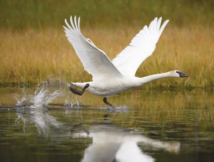
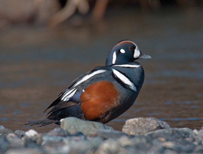
Bird Life
From geese and ducks to cormorants and cranes, at least 37 species of waterbirds inhabit the ponds, lakes, river and wetlands of the Bristol Bay drainage study area, with 16 species using the Cook Inlet drainage study area. Some come to breed, others merely passthrough on their migration. Hundreds of ducks gather in the lower Iniskin River in preparation for spring and fall migrations, for example.
The area is also home to raptors—eagles, falcons, owls, ravens and more. Over two seasons—2004 and 2005— researchers identified 73 raptor nests in the mine study area belonging to seven species, and 23 nests in the much smaller Cook Inlet study area belonging to three species. In both areas, bald eagle nests were the most abundant of all.
And of course, there are the landbirds and shorebirds—neither waterfowl nor raptor. These typically smaller, colorful birds swarm the area each summer.